

In the field of urban planning, "Urban Planning & Visualisation - Seeing the Big Picture" represents the intersection of strategic design, technology, and storytelling. As urban projects grow more complex, visualisation helps planners, stakeholders, and the public understand intent, justify decisions, and align project goals effectively.
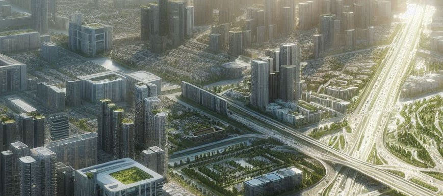
Clients and community stakeholders expect clarity and engagement. Traditional maps or drawings rarely convey the spatial and functional dynamics of a city plan. 3D visualisations, interactive models, and animated fly-throughs allow viewers to comprehend scale, traffic flow, and infrastructure placement—helping planners communicate plans effectively.
Urban planning requires collaboration between architects, planners, engineers, and government agencies. When BIM, GIS, and real-time rendering platforms are integrated, data flows seamlessly, reducing errors and accelerating approval processes. This ensures more predictable project delivery and cost control.

“Visualising the city in 3D allows stakeholders to see not just buildings, but the interaction of communities, infrastructure, and environment.”
Both realistic and stylised visual styles are employed. Photorealistic renders communicate materiality and infrastructure, while conceptual graphics convey zoning, green spaces, and public flow. Combining approaches guides viewers from understanding concepts to envisioning implementation.
Sustainability is a critical factor. Overlaying environmental and traffic analyses—solar exposure, airflow, energy performance—into visual outputs allows planners and communities to see the impact of sustainable strategies on urban comfort and functionality.
Narrative-driven presentations—interactive tours, phased animations, or visual reports—help sell urban projects to municipal authorities, investors, and the public, creating transparency and trust in planning processes.
Automation and AI assist with repetitive tasks, such as procedural city modeling, automated simulations, and smart scenario analysis. Human expertise remains crucial to interpret data, refine designs, and make informed planning decisions.
"Urban Planning & Visualisation - Seeing the Big Picture" highlights a discipline that blends technical insight with community-focused storytelling. Using integrated workflows and interactive visualisation ensures clearer outcomes, stronger stakeholder alignment, and more resilient urban development decisions.